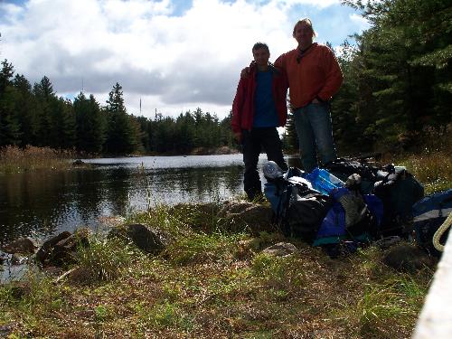
Chiniguchi Canoe Trip - Sept./Oct. 2010From Wednesday September 29th, to Sunday October 4rd 2010, Dan Payne and I treked into the solitude of the Chiniguchi area, North-East of Sudbury Ontario (between Sudbury and Temagami, as the crow flies.) The following map shows our route.
Chiniguchi is an area I've been wanting to paddle for many years. This region is crown land, and some of the area is partially protected as a non-operating park. But, because there are no permit fees or reservations required, the area can be a zoo in prime paddling season. Alas, Fall 2010 finally provided the opportunity (and time window) to paddle Chiniguchi off-season. As a frequent paddler in reservation parks such as Killarney, Massassauga, Haliburton and Algonquin, I was leary of what Chiniguchi would be like. Would the camp sites be a mess, would hunters' gun shots be bouncing off the hills, would the loggers have stripped the forest bare? All my worries were put to rest, as the area was very remote, mostly untouched, camp sites in reasonable shape and not too worn out, and whatever hunters were in the area were far away from the paddling routes. In fact, once we got past Wolf lake, we saw and heard no one for days, providing an isolation that was rare for me, even comparing to the farthest north sections of Killarney PP. Day 0: Tuesday Sept. 28thDan and I planned to leave late Tuesday afternoon, and crash at the Hungry Bear Restaurant & Motel south of Sudbury on highway 69. This would give us an early start to the trip on Wednesday, and allow us to cover some good distance on the first day. For early and late season trips in Killarney and farther North, I like going up the night before and staying there, otherwise known as the French River Trading Post. Certainly nothing fancy, but more than sufficient. If you're arriving very late, as we were, they simply leave the key pinned to the room door with your name on it. It took us a bit of time to get on the road, as we needed one last stop at the grocery store to cover off a few items Dan was not so sure on from the shopping list. With steaks and coffee packed, we got trucking, making our way to highway 400 North to Barrie, and beyond. Tripping in early October is always a weather-adventure, not made any easier given that the forecast was calling for some wet cool days and cold nights. My cautionary advance reports to Dan must have sunk in, as I helped him sort through the mountain of clothing he had packed that night at the motel! With half of the redundant clothing set aside, we managed to get his pack down to a reasonable size ("layers dude... it's all about layers".) We woke to a gray, cool drizzly day, as expected. A classic breakfast at the Hungry Bear restaurant, and we were off. We got off highway 17 just east of Sudbury onto Kukagami Road, and traveled north. The dirt road was in far better condition than I expected, as several trip reports I had read warned of crater-sized pot holes, mad logging trucks, and gun-toting red necks. We say none of the above, and made it up to Matagamasi Lake without a hitch. For details on how to get to the access points for Chiniguchi, there is no better resource than the Ottertooth.com web site. Day 1: Matagamasi to Wolf LakeWe had decided to park our vehicle at Lakeland Lodge. This meant we entered the water from Portage Bay on Lake Wanapitei, adding an extra kilometer of paddling and a short 100m portage to Matagamasi Lake itself. But, this is a worthwhile price to pay, to ensure your car is safe. I had read trip reports that the government dock on Matagamasi is small, over-crowded, and tires have been slashed in the past. The folks at Lakeland Lodge were extremely helpful on the phone, and charged only $2 a day for parking... compared to the $14/day rates that Hartley Bay Marina charges in the French River, this was nothing! If you plan to park at Lakeland Lodge, just call a few days prior, and they will sort you out with simple instructions.
We had just finished the first small portage along the road between Portage Bay and Matagamasi, when a guy on an ATV drove up from Lakeland Lodge (their lodge is on an island in Portage Bay, so we didn't actually see anyone at the launch.) We chatted for a bit, and learned a bunch about their core business, which is outfitting and guiding hunting trips, which in the Fall, means bear hunters. We learned that the Europeans come over with bows, and show incredible hunting skills without guns. Americans, their other main source of customers, like the Big Guns, and can always be found at the before the end of the day waiting by the road side for pick-up before spooky darkness sets in. I asked if we had to be careful for hunters in the area, and we were told no, the hunting is done far away from the canoe routes. Indeed, this proved completely true, as we never say a single hunter, nor even heard a gun shot. As we paddled up the North (West) arm of the Matagamasi to Wolf Lake, I was amazed at how few cottages there were. Having paddled in crown land several times, I had expected a far more cottages and boats. Once we got into the North arm itself, there were no cottages at all, and we never saw a single boat in the water (admittedly, it was mid-week, cold, threatening rain, and most cottagers were done for the season.) We did see an eagle flying high on a ridge line, which was a great start to the trip.
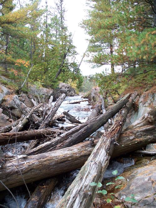
We had learned that the youth group was planning to camp on the north end of the lake, and was staying put there and returning a couple days later. So, we decided to camp at the site in the 'cut' midway on Wolf Lake. The site was clean and well maintained: these local outfitting companies depend on this area for their trips, and clearly respect the land, and are good stewards. Throughout the trip, this proved true: camp sites were clean, unlike some in Temagami I've dealt with that were littered with garbage, requiring extensive clean-up. Although this camp site happened to have a thunderbox, it was in serious need of a new home, so I dug two new holes, and relocated it (one for the surplus waste poking out, and one for the new box location.) We tried a bit of fishing from the site and in Wolf Lake, but the weather started looking worse and the wind picked up, so we headed back to camp. We stuck to hamburger steaks on the fire, which was just fine after a good first day of exercise in the 10C degree weather. Day 2: Wolf Lake To Chinguchi Lake
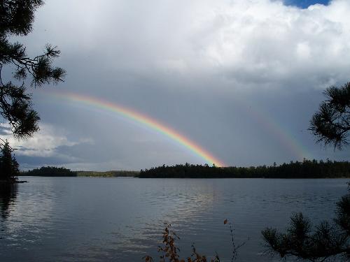
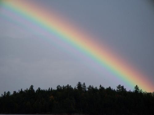
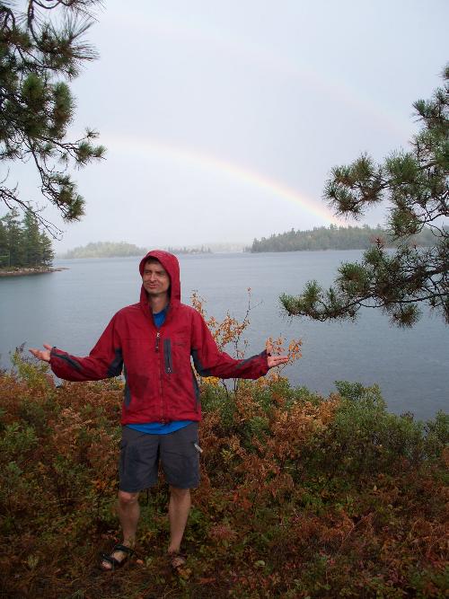
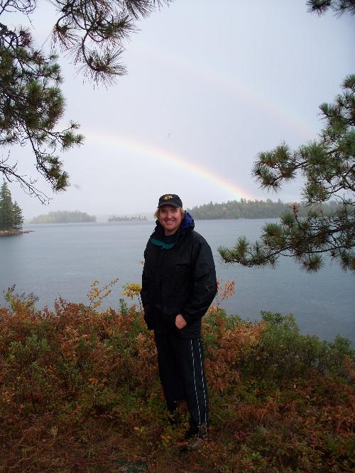
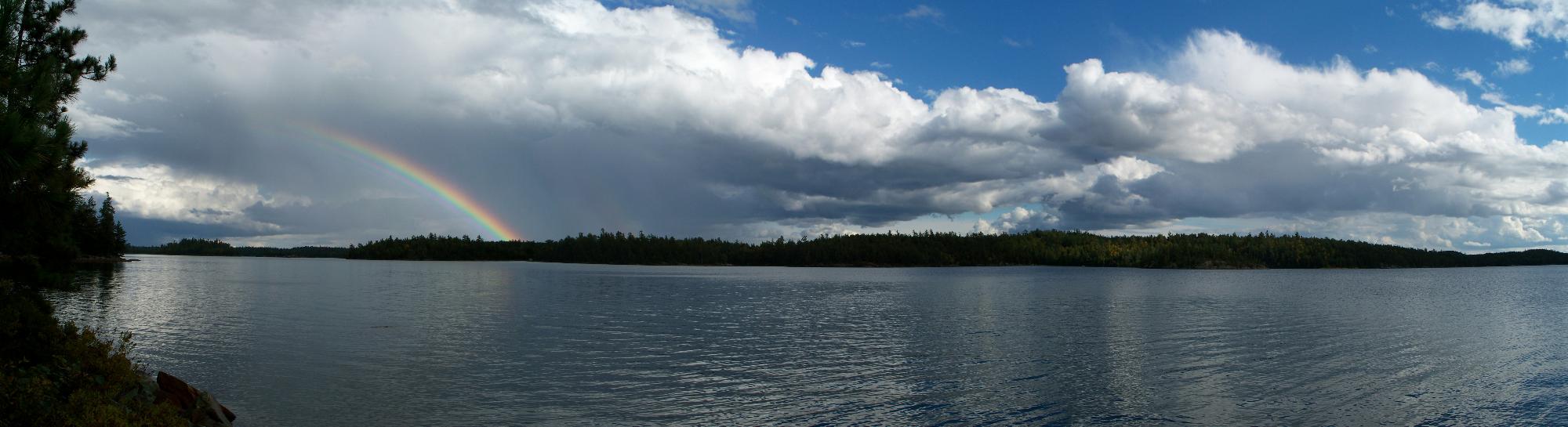
And if the above pics were not enough, here is a short video of the "Double Raindow" experience.
Day 3: Chinguchi Lake to Evelyn Lake
Dan had conveniently forgotten to bring a second pair of footwear and had no sandals or water shoes, so this presented another challenge to the crossing. And there's no bypassing the swamp, as it's really a long valley-swamp, with no way around. So I threw on my sandals, stripped down to shorts, grabbed a big stick, and began trying to scout the trail with just my pack. My stick went down 6 feet in spots, and whatever logs and sticks have been thrown down for walking on were 6 inches under water and hidden. It was dangerous, as a misstep could mean going up to your arm pits, or worse. Dan tried jumping from bog mat to bog mat, but this approach petered out half way with no way to continue.
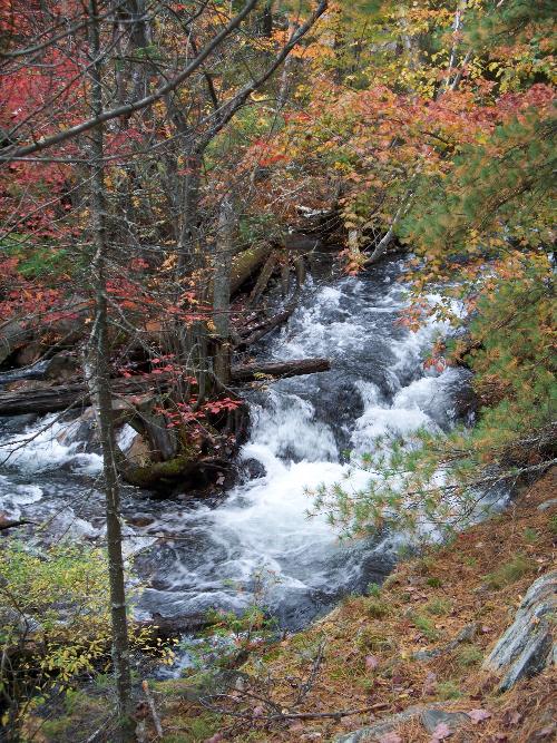
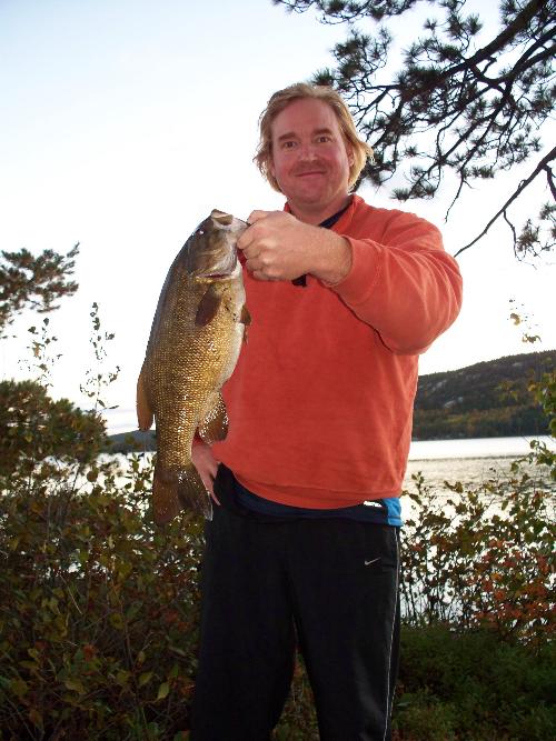
The weather continued to change several times during the day as we made our way down to Evelyn Lake. Rain then sun, sun then rain. But weirdly, the wind seemed to always be behind us, even as we changed direction from East to South. This was good, as there was full white caps with 2 foot chop at times. The island camp site on Evelyn Lake was fantastic once again, with a great ridge-top setting and sunset view. Stuffed with rehydrated beef burrittos for dinner, we were ready for the cold night that set in. Day 4: Evelyn Lake to Matagamasi/McCarthy BayAnother gray drizzly day, with cold wind and tempting segments of sunshine. You'd think it was late October, not late September! But it was hard to seriously complain, given the amazing remote location, and total lack of encounters with any one else. We also had been able to star-gaze a bit that night on Evelyn, which I rarely get a chance to do in prime July/August season, given that the bugs usually drive you tent-bound before the sky is dark enough. The portages in this section were not maintained as well, which meant some tight squeezes with my 17'6" Swift Temagami ultra-light canoe. On some portage sections, it was more a case of just going from flagging tape to flagging tape, avoiding whatever trees you could. But nothing was too onerous, especially compared to the swamp hell we had experienced the day before. After returning to McCarthy Bay, which connects to Matagamasi Lake, we saw our first cottage in the distance since before Wolf Lake... the usual sign that a trip is coming to a close. We paddled South a couple of kilometers to nice camp site, which included a well-serviced and useable thunderbox. We tried a bit more fishing, but had no luck: we would have to be thankful for our one monster bass. Instead, we enjoyed a tasty pizza for dinner. That night, around 10pm, we could hear odd sounds in the near distance. Dan thought it might be gun fire, but it repeated every couple of minutes, and sounded more like rocks being smashed together. So, we quickly got dressed (it was down to 3C at that point), and headed to the shoreline where we could hear the noises across the bay. At this point, it really sounded like rocks being flipped over along the shoreline, some of which would 'sploosh' into the water. And not small rocks, gauging from the deep echoing splooshes! We knew there were no cottages, camp sites or anyone else around, so our imaginations started racing. A racoon looking for cray fish along the shoreline... no, those rocks being flipped were way too big. A beaver dragging logs or actively working the shoreline... no, it was definitely big rocks being flipped into water. Which left... a bear, flipping rocks into the water along the shoreline. So, flashing our headlights across the water and a few hoots and hollers, the commotion then stopped. We headed back to the tent, quite aware of the very short distance across the water to our camp site! On return, I queried some other paddlers online about this, and found some who had heard the same sounds during the day, and discovered a bear doing exactly what we had guessed: overturning rocks looking for food (probably crayfish.) Mystery solved, thankfully without incident. Day 5: Matagamasi/McCarthy Bay to Access Point
Other Useful Chiniguchi Resources | |||||||||||||